Looking for a Ship (10 page)
Read Looking for a Ship Online
Authors: John McPhee

In some ways, we may be better off not getting much of anywhere. We have books and pamphlets aboard that warn of the hazards of South America, none in such replete fashion as Rand McNally's “South American Handbook,” which is the definitive compilation in its field and is published in England. With respect to peril, the places we visit stand high in this book. It ranks Ecuador, Colombia, and Peru as countries where a traveller would be justified in feeling least secure. Intended for readers who have decided to expend large amounts of time, money, and energy on journeys in South America, it is a sort of welcome mat with land mines in it. Something seems to explode from almost every page:
Always carry your passport with you; if it is not in your possession you may be taken to prison.
Â
You can be fined on leaving the country for staying too long.
Â
Don't get into ⦠conversations ⦠with any locals if you can help it.
Â
Beware of locals who smear mustard (or something worse) on you, and while you are cleaning it off, steal your belongings.
Â
Beware of armed robbery; at roadblocks it is best not to get out of your car.
Â
Be especially careful of people who describe themselves as plain-clothes police.
Â
Never accept food, drink, sweets or cigarettes from unknown fellow-travelers on buses or trains. They may be drugged, and you would wake up hours later without your belongings.
Â
Mugging, even in daylight, is a real threat.
Â
Hide your main cash supply.
Â
Take spare spectacles.
Â
Try not to resist.
Â
Don't pick up money in the street; it is often a ruse to rob you.
Â
Avoid staying in hotels too near to bus companies, as drivers who stay overnight are sometimes in league with thieves.
Â
Robbery is common on the beaches and you are advised to sit on your clothes.
Â
You shouldn't take a taxi which has 2 people in it as you may get mugged or robbed.
Â
We have received reports of drug-planting ⦠on foreigners in Lima, with US$500 demanded for release.
Â
The activities of the “maoist” guerrilla movement, Sendero Luminoso, are spreading ⦠. They have no love for foreign tourists.
Â
Travel in the departments of Ayacucho, ApurÃmac, and Huancavelica ⦠is hazardous as there are many police and troops in the area fighting guerrillas and detaining suspects.
Â
Tourists in the Callejón de Huaylas have been attacked, not so much by local people, but particularly by dogs.
Â
There are excellent hospitals in both Quito and Guayaquil.
Â
Many people have been badly poisoned by eating the blue berries which grow near the lake; they are not blueberries, they render the eater helpless within 2 hrs.
Â
Milk ⦠is rarely pasteurized and, therefore, a source of tuberculosis, brucellosis, and food-poisoning germs. This applies equally to ice-cream, yoghurt and cheese.
Â
Stand your glass on the ice cubes rather than putting them in the drink.
Â
Locals sell necklaces made with red and black Rosary Peas (Abrus pecatorius), which are extremely poisonous.
Â
Rabies is endemic throughout Latin America so avoid dogs that are behaving strangely, and cover your toes at night to foil the vampire bats.
Sailors have returned to the Stella Lykes clothed only in their undershorts. The muggers peel them like bananas.
Glimpses of Guayaquil: Heavy construction, bamboo scaffolding ⦠Rubber trees in the medians of streets ⦠Shrimp cocktails in double gobletsâthe cooked shrimp in a glass sphere, surrounded by live, swimming fish ⦠A checkerboard on a bicycle seatâa game being played with bottle caps, half of them upside down ⦠In the heart of the city, the perched iguanas high in the branches of trees ⦠The four clocks of the cathedral towers, each agreeing with the others, all correct twice a day. In the broad savannas across the Guayas, dark beans drying in the sun, green bananas beside the road. Papayas. Pineapples. Mangoes. Cane. The shrubs of coffee. The evergreen cacao. Billboards warning of “DROGADDICCIÃN.” A clear-plastic bag of what appears to be gazpacho hanging from the handlebars of a policeman's motorcycle. Since the ship. sails in two hours, it is time to return to the ship.
Glimpses of Valparaiso: Men in topcoats, women in fur-lined boots, the leafless trees, the dank English air, the February aspect of August ⦠Grandmothers chewing bubble gum ⦠As the hills go up, values go down. The streets are ever poorer as they rise. Darwin:
The town is built at the very foot of a range of hills, about 1600 feet high, and rather steep ⦠. The rounded hills, being only partially protected by a very
scanty vegetation, are worn into numberless little gullies, which expose a singularly bright red soil.
scanty vegetation, are worn into numberless little gullies, which expose a singularly bright red soil.
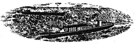
The gullies, still numberless, are lined with houses, each one higher and simpler than the last, grading upward into shacks. Halfway up the hill is a prison with a cracked wall. From the yard inside come the voices of prisoners singing in chorus. At elevation fifteen hundred feet, the door of a tin shack opens. A woman emerges who would not look amiss crossing a Fifth Avenue sidewalk to a stretch limo. She walks beside a gully on a dirt path to a street, where she waits for a bus. From sixteen hundred feet, the view is of two cities (Valparaiso and Viña del Mar) in amphitheatrical bays, Stella Lykes in the toy harbor.
In Ecuador, Duke Labaczewski buys panama hats. He says they are better hats than he could buy in Panama. They are made underwater. He takes them to New Jersey and gives them to priests. In Valparaiso, crewmen buy stuffed piranhas. In Lima, they buy framed tarantulas. They buy framed bats that have the wingspans of sharp-shinned hawks. They drink a cream soda called Inca Cola. They look into the faces of uniformed men and women in flak vests and riot gear who carry tear-gas guns and rifles. They watch the armored vehicles with the turret-mounted water cannons. They retreat to the seaport, Callaoâto the Happy Landing Night Club, to Anna's, to the Loussiana Bar. In Guayaquil you will find them in Anita's.
Evening, August 11th. Twenty-nine degrees south. The end of the first clear day in more than a week. The
watch concludes in darkness. Rigil Kentaurus and Hadar point to the Southern Cross. At sea or ashore, of all our hurried glimpses here in the southern ocean, this is the most movingâthis small, elegant assemblage of four proportional stars. They form a perfect shape. They are so unprepossessing that the attention they attract will not give way.
watch concludes in darkness. Rigil Kentaurus and Hadar point to the Southern Cross. At sea or ashore, of all our hurried glimpses here in the southern ocean, this is the most movingâthis small, elegant assemblage of four proportional stars. They form a perfect shape. They are so unprepossessing that the attention they attract will not give way.
Â
Â
There is a long quiet on the bridge. It is finally broken by McLaughlin, speaking in the dark from the helm. He says, “One of the foreign ports where I never go ashore is Miami.”
“Did you go ashore in Valpo, Mac?”
“I went ashore in Valpo.”
“How far did you get?”
“To the first bar.”
N
orth through the night at thirteen knots doing ten-second rolls in the long Pacific swells.
orth through the night at thirteen knots doing ten-second rolls in the long Pacific swells.
Lying in your bunk, you can feel your brain sloshing back and forth. With your chin on your pillow and your arms spread, you are flying. Bank left. Bank right. Six banks a minute. As the ship heels, creaking, it sounds like a ratchet. Loose objectsâ“The Voyage of the Beagle,” the “American Practical Navigator,” the Casio HL-802 electronic calculator, the Seiko Quartz Snooze-Light alarmâhave long since shot across the room, hit the walls, and fallen to the floor, where they move, and tumble against one another, like rocks in the bed of a stream. These big winter swells come all the way across the Pacific from New Zealand, six thousand miles, to close the ports of South America. They closed Valparaiso before we were there and will close it again within the week. And now we have come into the southeast trades. The wind, blowing on our starboard
quarter, is perpendicular to the long swells, and the result is a confused sea.
quarter, is perpendicular to the long swells, and the result is a confused sea.
On the bridge, before day, Calvin King's presence at the wheel is signed by the glow of his cigarette. Calvin seems to live on smoke. He stands steady, and seems not to notice any motion but the ship's heading. One assumes that if the ship were going down he would continue to inform the mate, in his slow Carolinian voice, “Three-four-one, three-four-one,” until his drawl became a gargle. His thoughts this morning are on the foundering not of himself but of the United States Merchant Marine, and the absence of opportunity for young sailors. “An entry man now, he's looking at a lost cause,” Calvin is saying. “To make a long arm shortâthe best I can sum it upâwe just don't have any ships.”
Vernon McLaughlin, by contrast, continues to be anything but oblivious of the rolling of the ship, of the turning of the shaft at a few revolutions per hour (or so it seems to him). As dawn passes, and he takes over as quartermaster, he says, “We are going backward. This is an ocean ship, rocking and creaking, and it's fucking monotonous.” He is reminded of voyages across the Pacific. Like Calvin, though, he is physically steady on the moving deck. It does not concern him that the ship is trying to throw him over a bridge wing.
Likewise Andy. As the heavens fade, Andy has been out on the port bridge wing shooting Achernar, Mars, Sirius, and Venusâplucking them from the drift of clouds. Good with a sextant, he resembles a Castilian shepherd drinking
wine. Ordinarily, he shoots the stars as an academic exercise, a way of keeping fresh his celestial navigation, which he figures out with his calculator and his dividers in the chartroom. As second mate, he enjoys his role as the ship's “navigator”âlaying out courses on charts. However, the essence of the navigation has been purloined by the computer SatNav, which receives its intelligence from satellites. Some days ago, Andy said, “I almost wish the SatNav would bust down, so I could do something more challenging.” This morning, he's got his wish. The SatNav's digital clock reads 10:08:19 Greenwich mean time. It has read 10:08:19 Greenwich mean time for two hours. As successive satellites have passed overhead, the SatNav has not accepted a fix. By taking fixes about once an hour, it ordinarily tells us, among other things, how far our next programmed way point is and where we are at the moment. In some places, such as the North Atlantic, there are redundant systems of electronic navigationâDecca, for example, in North Europe, in addition to loran and SatNav. A nervous ship may be using them all. Down here in the Southeast Pacific, SatNav is alone. Other electronic systems are not in place here, or anywhere near here. The SatNav includes a feature called automatic heading, but in fact it doesn't know what your heading is unless you tell it. Having shot the stars and now the rising sun, Andy knows where we are. He wants to tell SatNav, but he is unable to. Like a person whose cursor has ceased to blink, he is locked out of SatNav's keyboard. He has never before faced such a problem. He is speed-reading the SatNav manual. He, too, is impervious
to the ship's roll. With his sextant, Andy could fix the horizon and shoot the sun from the bar of a flying trapeze.
Steaming south, when we did not see sun or stars from Guayaquil to Valparaiso, SatNav got us there. “If the SatNav is out and you can't use your sextant, you stay on dead reckoning,” Andy remarks now. “You will see the coast on radar long before you hit anything. If the radar conks out, the problem becomes larger.”
Captain Washburn arrives on the bridge, previously informed and unconcerned. He says he never uses SatNav anyway. Like Dirty Shirt George Price and Rebel Frazier, he has an instinct for dead reckoningâthe deduced reckoning of one's position from recorded course and speed. He says, “Every once in a while, we have to tell SatNav, âHey, fool. We're over here.'”
SatNav, in its time, has been known to reciprocate. The development of satellite navigation has brought some embarrassment to the hydrographic charts of the world. For example, we happen at the moment to be on the “Pisco to Arica” chart of the waters of Peru and Chile, which dates to the British survey conducted in 1836 by Captain Robert Fitzroy, of the Beagle, with additions and refinements through 1958. As a result of satellite navigation, a large purple box has been added to this chart warning that a stretch of coastline near Punta del Infiernillo is almost two miles closer to Australia than its charted position. New York is where it thinks it is, but, until recently, if you looked at the chart of the “Gulf of Mexico and Caribbean Sea” you discovered that the entire island of Antigua was “reported
to lie one and a quarter miles northward of its charted position.” When Andrew Marvell, in the sixteen-fifties, reported that “the remote Bermudas ride in the ocean's bosom unespied,” he was singing the song of SatNav, which showed that Bermuda was not in its charted position. Satellite measurements found that several of the Caroline Islands were misplaced by as much as three miles. Cartographers have had to move Africa.
to lie one and a quarter miles northward of its charted position.” When Andrew Marvell, in the sixteen-fifties, reported that “the remote Bermudas ride in the ocean's bosom unespied,” he was singing the song of SatNav, which showed that Bermuda was not in its charted position. Satellite measurements found that several of the Caroline Islands were misplaced by as much as three miles. Cartographers have had to move Africa.
Andy and the captain discuss their sextantsâcomparing their astigmatizers, their ability to pluck bodies out of clouds, their need to filter the brilliance of first-magnitude stars. This may be the only sextant shootout I will ever see. The captain admits to the difficulties he has when he tries to work with a bubble sextant but asserts that he can sense the horizon even if he can't see it. He says, “I've got a bubble inside my head that the rest of you guys don't have.”
On merchant ships, they still marvel that John Wayne could read latitude and longitude right off his sextant on the bridge wing of a ship of the U.S. Cinemarine. Moreover, he did it on a cloudy day.
Andy likes to quote something he calls Higgins' Law, which comes off a wall at Maine Maritime: “USE ONE ELECTRONIC SYSTEM AND YOU ALWAYS KNOW WHERE YOU ARE. USE MORE THAN ONE AND YOU'RE ALWAYS IN DOUBT.”
I have asked him if merchant ships can get along without celestial navigation.
“No” was his reply. “It's the one thing that doesn't rely on power. There is nothing else to fall back on when SatNav
fails. Licensed deck officers don't really need to understand nautical astronomy, though. They just have to know how to do it. They don't need to know the constellations. They can use the sight-reduction tables for selected stars. You can shoot a star by looking first in the tables for its altitude and bearing. Then you set the sextant and shoot it.”
fails. Licensed deck officers don't really need to understand nautical astronomy, though. They just have to know how to do it. They don't need to know the constellations. They can use the sight-reduction tables for selected stars. You can shoot a star by looking first in the tables for its altitude and bearing. Then you set the sextant and shoot it.”
The gyrocompass runs on power. The gyro informs the automatic pilot. Not only does the gyro have to be running; it has to be running properly. A merchant ship left Philadelphia for South America and ran aground on Long Island. When the ship was leaving Delaware Bay, the gyro evidently lost power and spun ever more slowly until it was at least ninety degrees in error. The power returned but the error remained. South became east, and north became west. The next day, the ship went aground in New York. Captain Washburn savors this story. “That was in the early nineteen-fifties,” he says. “She started for South America and hit Fire Island. On the way, she went through three or four watches, and no oneâno one, as in not oneâchecked the gyro against the magnetic compass. A gyro being as much as a hundred and eighty degrees off is not that uncommon. That story of the grounding on Fire Island is meant to show you, âHey, that gyro is just a machine and it can malfunction. Hey, check the equipment. Check that gyro with the magnetic repeatedly.' That is why they use that story in classes. Hey, if just one guy on one watch had checked that gyro against the magnetic and said, âHey, something's bad wrong here,' that wouldn't have happened. The ship went through at least three watches before it hit
Fire Island. All
three
watches were involved. When they were aground, they had no idea where they were.”
Fire Island. All
three
watches were involved. When they were aground, they had no idea where they were.”
Andy says, “The insidious thing is that so much of your equipment is calibrated to that gyro. As the gyro wanders off course, everything else wanders with it. So everything agrees. Everything checks out. Your autopilot will follow it around ever so slowly. Your course recorder won't show a change of course. Your radars will agree with it. Everything else will agree with that gyro.”
Captain Washburn was leaving Charleston one time and had settled in his bunk for a nap when sunlight came streaming through his porthole. Given the hour and the ship's intended heading, sunlight coming through the porthole was about as alarming as a flood of green sea. In a few seconds, Washburn was on the bridge. “The gyro said ninety but it was really two-seventy, and we were heading back for Charleston,” he says, continuing the story. “Meanwhile, the mate was up there leaning on his chin, you know, heading away from the sun, the ship turned all the way around, a hundred and eighty degrees, going back, you know, and all of this isn't registering. We were just starting the tripâand I'm supposed to go below and
sleep
with him on the bridge?”
sleep
with him on the bridge?”
In the eighteenth century and before, a ship's captain would almost always be the only person on the ship who could calculate the ship's position. He used the instruments and possessed the skills of navigation. The chronometer came into use in the seventeen-sixties. The sextant was invented in 1731. Cruder devices for measuring the angles
between celestial bodies and the horizonâthe astrolabe, the cross-staffâpreceded the sextant. Whatever the instruments were, they were emblematic of the captainâthe one person who could get the ship from A to C without veering off to G or wrecking it on B. This godlike knowledge helped to subordinate the crew and, if things went sour, to prevent mutiny. If you threw the captain overboard, who would get you home?
between celestial bodies and the horizonâthe astrolabe, the cross-staffâpreceded the sextant. Whatever the instruments were, they were emblematic of the captainâthe one person who could get the ship from A to C without veering off to G or wrecking it on B. This godlike knowledge helped to subordinate the crew and, if things went sour, to prevent mutiny. If you threw the captain overboard, who would get you home?
Nathaniel Bowditch, of Salem, Massachusetts, who was born in 1773, undertook to bring navigation out of the realm of mystery and into the understanding of ordinary seamen. His first pupil was himself. He did not go to school beyond the age of ten. He went to sea at twenty-one. He was the skipper of a merchant ship before he was thirty. He taught his sailors math. He taught them navigation. Like every other ship's master, he used John Hamilton Moore's “The Practical Navigator” as a text, but after he had found and corrected eight thousand errors in Moore's book he rewrote it completely and, in 1802, published it under his own name. This became the “American Practical Navigator,” subtitled “An Epitome of Navigation.” There is one on every Navy ship, one on every merchant shipâa copy in the chartroom of the Stella Lykes. The book has long since been taken over by the Defense Mapping Agency of the Department of Defense and is continually revised. Universally, it is known as Bowditch. It is two thousand pages long, includes vastly more than how to get from A to C, and, from its star charts to its discussion of relative bearings, is the Britannica of the sea. If John Wayne had known what
he was doing, he would have put down the sextant, picked up a pencil, and referred to the tables in Bowditch.
he was doing, he would have put down the sextant, picked up a pencil, and referred to the tables in Bowditch.
Andy Chase owns Nathaniel Bowditch's sextant. This is not the sort of thing he is likely to confide to the captain. When Andy goes on ships, he doesn't take it with him. He takes another. He leaves the heirloom at home and will someday present it to a museum. I stumbled across this curious fact when Andy was trying to teach me how to use a sextant, and I was looking for the angle of Mimosa, a star of the Southern Cross. There were aspects of Andy's background that had long puzzled me. For example, he had studied in a New England prep school, just about the last milieu one would imagine as a nursery for the Merchant Marine. Yet he took off from the school and shipped out on a bulk carrier. One of his grandfathers was a professor of history at Harvard. To be sure, when Andy was born his father was running a boatyard on Long Island Sound, and he later worked for a tuna company and flew the world as a sort of water-pack diplomat, visiting the tuna industries of numerous countries. But, for all that, I was struck by the apparent paradox between the fabric of Andy's origins and the romantic profundity of his attachment to the sea. And I remained so until this morning, when I was trying to hold the bright Mimosa in the index mirror of the sextant, and he told me about the priceless old sextant at home, and explained that it was there because Nathaniel Bowditch was his great-great-great-grandfather. On page 3 of the current edition of the “American Practical Navigator” a naval historian says that Bowditch learned more than twenty languages
in order to be able to acquire the navigational knowledge that he passed along to American sailors. When Andy called at Leningrad on the Waterman freighter Thomas Jefferson, he studied the names on Russian ships from the launch that carried him ashore. The names generally appeared twiceâin both Roman and Cyrillic characters. Before the launch reached the dock, Andy had figured out the Cyrillic alphabet, and he was able to get around in the city on buses. In common with numerous sailors on the Stella Lykes, Andy has a tattoo on his right forearm. Off the bulk carrier Kristin Brøvig, he went ashore near Sydney, aged sixteen, and looked around for a parlor. He explains that he chose to do this where he did for “the pure sound” of the word “Australia”; that is, it would never do to be tattooed in a place like Scranton. “It was a romantic notion. I wasn't drunk. I wasn't impulsive. I damned well wanted a tattoo. My brother had a tattoo. Real sailors had tattoos. People tell me I'm supposed to regret it. Unless you're convinced you want it, you shouldn't do it. There ain't no turning back. I've never regretted it. I looked at the sketches all over the walls, and picked out the one that I wanted. It's a square-rigger coming over the horizon, coming out of the rising sun.” When Andy was in his teens, he sailed five thousand miles working for his brother Carl, who was the skipper of a schooner called Nathaniel Bowditch.
in order to be able to acquire the navigational knowledge that he passed along to American sailors. When Andy called at Leningrad on the Waterman freighter Thomas Jefferson, he studied the names on Russian ships from the launch that carried him ashore. The names generally appeared twiceâin both Roman and Cyrillic characters. Before the launch reached the dock, Andy had figured out the Cyrillic alphabet, and he was able to get around in the city on buses. In common with numerous sailors on the Stella Lykes, Andy has a tattoo on his right forearm. Off the bulk carrier Kristin Brøvig, he went ashore near Sydney, aged sixteen, and looked around for a parlor. He explains that he chose to do this where he did for “the pure sound” of the word “Australia”; that is, it would never do to be tattooed in a place like Scranton. “It was a romantic notion. I wasn't drunk. I wasn't impulsive. I damned well wanted a tattoo. My brother had a tattoo. Real sailors had tattoos. People tell me I'm supposed to regret it. Unless you're convinced you want it, you shouldn't do it. There ain't no turning back. I've never regretted it. I looked at the sketches all over the walls, and picked out the one that I wanted. It's a square-rigger coming over the horizon, coming out of the rising sun.” When Andy was in his teens, he sailed five thousand miles working for his brother Carl, who was the skipper of a schooner called Nathaniel Bowditch.
Other books
Snared by Norris, Kris
JENNY LOPEZ HAS A BAD WEEK by Kelk, Lindsey
A Leap of Faith (The Hands of Time: Book 2) by Irina Shapiro
Carl Weber's Kingpins by Smooth Silk
Fuzzy by Josephine Myles
After the Rain by John Bowen
Allegiance by Wanda Wiltshire
Something Quite Beautiful by Amanda Prowse
The Staircase Letters by Arthur Motyer
A Major Seduction by Marie Harte